|
Akhmim, sometimes referred to as Echmim, is located in the region known as Upper Egypt, North East Africa (shown
on the survey of Egypt map 43/690 scale 1:25,000) and situated on the East bank of the Nile in close proximity to a sharp
bend in the river. (fig 2) The town itself lies approximately three kilometres east of the modern town of Sohag (the Governate
of Sawhay muhafazah, one of Egypts 26 governates) comprising a population of circa 75,000 and a small university.
Akhmim
lies approximately on Latitude 26 30' South and Longitude 31 45' East (fig. 3) being 475 kilometres South of Cairo and 200
kilometres North of Luxor. The town occupies the site of the ancient Khemis, the Panopolis of the Greeks and once the flourishing
centre of the important ninth Upper Egyptian nome. This particular historical aspect of Akhmim will be discussed in more detail
in the Historical Background
The main morphological features in this area consist of high hills, terraces and undulating
plains. The quaternary deposits (geologically the most recent phase of earths geological past, from two millions years ago)
consist of gravel, terraced alluvial (fine fertile soil left during a time of flood) and well cemented deposits. The gently
sloping surface, with its deeper soils, is intensively cultivated, while the barren hills are characterised by steep slopes.
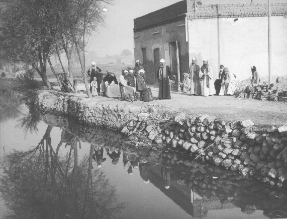
In addition to the river Nile the site is now served by a principal road, running from Aswan in the South to Cairo
in the North, a few desert tracks and the El-lsawiya canal, while the rail network is located at Sohag on the West bank. The
cemeteries of Akhmim include that of El-Hawawish, North East of the town, where the hills rise some 300 metres in height from
the barren plains of capped conglomerate limestone and overlooking the Nile valley. The site is honeycombed with over 800
tombs of the Old Kingdom (Kanawati, 1988) and later periods, where some of the tombs were made for officials of Panopolis
, while further North is the cemetery of El-Salamuni, where the rock chapel of Min may be found, (AKH/046) originally built
by Ay, 18th.Dynasty ruler (1325-1321 BC, see also the section on the historical background) and later restored by Harmakheru,
Chief priest of Min in the reign of Ptolemy II Philadelphus (285-246 BC)
Akhmim lay in a central position, between
the Old Kingdom capital of Memphis at the junction of the Delta and Nile valley, with Aswan on the Southern border and one
of the most productive areas of the valley. The patron god of Akhmim is the fertility deity Min, where, in Hellenistic times
it was identified with Pan, whence the name Panopolis (city of Pan). The somewhat mysterious but interesting background of
Min is covered in some detail in the following section.
Go to Chapter 3
Go to chapter 3
|